Friday, April 26, 2013

Eastern Sierra Nevada

Leaving Death Valley for Lone Pine, CA

By our fourth day, we realized we could stay in Death Valley for a week or two at least.  However, this trip was a reconnaisance to plan for the future. Next time we will arrive in February to avoid the heat and the crowds of March. The big question was how to drive over to Lone Pine, our next objective.
We did our research online as well as talked to quite a few travelers and rangers about the best route.  On the map, it looked like 190 was the way to go.  Comments about this route varied from "insanity with a motorhome" to "an easy way to go."  I decided to go for it, rather than spend several extra hours going through Beatty, Tonopah, and then over to 395.

By going slowly and using second gear, it was an easy trip going through Panamint Springs up to Owens Lake and connecting with 136 to Lone Pine.  The views are spectacular, well worth the ups and downs on excellent roads.

Lone Pine and Tuttle Creek Campground

It's an amazing journey to the Eastern Sierras from the desert observing Mt. Whitney as our navigational beacon. Comfortable temperatures and sunny conditions welcomed us to route 395, one of our favorite drives in the USA.  Last year we had explored a number of campgrounds in the region and we had settled on Tuttle Creek, a BLM campground nestled beneath the shadow of Mt. Whitney, just above the Alabama Hills, and a few miles from Lone Pine, California.  This is one of our very favorite campgrounds in the American west.  For a fee of $2.50 a night (dry camping), we were snuggled into a site with shade trees not more than ten yards from a trout stream recently stocked with 12-14 inch Rainbow Trout.  It just doesn't get much better than this!


View from Lone Pine past the Alabama Hills to Mt. Whitney


At Home at Tuttle Creek BLM Campground


Tuttle Creek, a few yards from our motorhome


A 13 inch Rainbow Trout for Dinner


Views past the Alabama Hills to Inyo Mountains from our Campsite


Evening Sunset towards the Sierra Nevada


Wednesday, April 24, 2013

Mesquite Flat Dunes

Stovepipe Wells

The thing about Death Valley is there are so many possibilities. And, it's relatively flat for easy driving in this part of the park. It was time for us to move on however, and we set up a new base camp at Stovepipe Wells, about an hour away from Furnace Creek.  We were especially attracted to the dunes and their easy access from the road close to the RV Park. Like yesterday, lots of wind but a drop in temperatures made it appealing to explore in the morning and evening.

Mesquite Flat Dunes

The Mesquite Dunes are a photographers paradise depending on the time of day. They are easy access from the road and I can see the movie companies from Hollywood coming here again and again for some prime footage. Just happens we are watching the old series of "Kung Fu" on DVD with David Carradine playing Kwai Chang Caine (Grasshopper) as a Shaolin priest. The first introduction of every episode starts with Caine trekking through these stunning sand dunes.  Now we have our chance of walking through them as well.  They are in a gorgeous setting with lofty mountains on all sides and rise up to 150 feet, primarily caused by erosion of the nearby Cottonwood Mountains.


Photography by David Roderick


Tuesday, April 23, 2013

Lowest Point in North America

Badwater Basin

Temperatures dropped in the early morning and cooled things off enough to encourage us to drive to Badwater Basin, the lowest point in North America, at 282 feet below sea level according to the sign, but Ranger Bob said it's now lower at "284 feet below".  Good enough for me! Visitors from all over the world joined us at the site, walking and gawking and clicking cameras to record this auspicious moment. I looked down and then up. OK! Where is Mt. Whitney, the highest point in the continental USA?  Couldn't see it but I heard there was an ultramarathon in a few months that goes from this very site to the trailhead of Whitney Portal (8360 feet).  It's described as the toughest race in the world with a 13,000 foot cumulative elevation gain.  And...get this. It's in mid-July when the temperatures are hottest all around.  How hot?  120 degrees and up.  That  adds up to about 157 miles on land with a course that has to go around lots and lots of natural obstacles, like salt beds, steep canyons, sand dunes, rattlesnakes, gold mines, and then bears as you get to the mountains. Just kidding. Or, am I? Originally it went all the way up to the top of Mt. Whitney at 14,494 feet above sea level.  But lots of regulations changed this event when the National Forest Service required permits to hike to the summit.  I did it over 30 years ago and it took me at least three days for the round trip from...no! not Badwater Basin...but from Whitney Portal.  Thank God I did it then!  


The lowest point in North America at 284 feet below sea level


Visitors from all over the world joined us at the lowest point in North America

Artist Drive

We then slowly drove in the direction back to Furnace Creek to take-in the majestic Artist Drive.
Turning to the right, away from the salt flats to the Black Mountains, we took a one way surfaced road that meandered through a series of volcanic rock layers painted in reds, purples, pinks,orange, yellow, browns, blacks, and whites...with all kinds of related hues and colors in-between.  A natural palette that is stunning to the eye.  Lots of places to walk and get out of the car for more detailed observations while being on the lookout for rattlesnakes and other creatures I have no wish to discover at 100 degrees.  This rock formation is actually called the Artist Formation dating back to the Miocene about 10,000 years ago during a particularly violent and explosive period of volcanic action.  The colors are due to "chemical weathering and hydrothermal alteration", especially the rocks that contain iron (hematite) as they tend to oxidize and yield the rusts and reds and browns and greens.  OK! I confess. My first college degree was in geology.  But the guidebook helps with the description.

A stunning panorama through the Black Mountains and the Artist Drive


The Inn at Furnace Creek

It was time to return to the cooler climes in such places as the Inn at Furnace Creek for a gin tonic to celebrate the fact that we are still alive and didn't fall down a crater to the center of the earth or get bitten by a giant rattlesnake or get eaten by a saber tooth tiger lurking around from the Pliocene.
In rather British fashion, we retreated to the deck overlooking the valley with a six dollar gin tonic in hand to toast each other for a good day's work done.  Of course, we will retreat to our RV domain at some later point, but in this air conditioned affluence, we enjoyed every minute of it.  The rooms here, for the rich and famous, start at $340 plus taxes and other fees, to $480 for a suite.  


The lovely Inn at Furnace Creek for those who prefer a bit of luxury in the desert


Monday, April 22, 2013

Death Valley National Park

Furnace Creek

Time to leave Pahrump, Nevada where we spent the past week getting ready for our annual spring trek to Route 395 and the Sierra Nevada with its lofty mountains, lakes, rivers, and creeks around Lone Pine, Bishop, and Mammoth, California. In my opinion, this is one of the most beautiful stretches of land in the world sharing the lowest (Badwater Basin) and highest points (Mt.Whitney) in North America. This year we decided to cut through Death Valley for a few days before camping, hiking, kayaking, and fishing our way up north to Oregon.


Entrance to Death Valley National Park along Rt. 190

                                     
Taking Rt. 160 out of Pahrump to connect with Rt. 190, it was less than an hour before we entered the National Park. Excellent roads along the way, especially within the park.  Met a great group of motorcyclists from Western Canada at the Park sign where we took photos of each other.        

Road into Furnace Creek along Rt. 190


Then into the park, bypassing Dante's View, but stopping at Zebriskie's Point.  Nola mentioned to me, "You know, it's kind of hot here at 2:00 PM." Little did we know the temperatures were over 100 degrees.  But the walk up to the Point is well worth the time and effort as a beautiful panorama of badlands with different hues and colors jump out at you. This is an ideal place for sunrises and sunsets.


The Badlands at Zebriskie Point


We drove slowly into Furnace Creek, admiring the luxurous Inn and more approachable Ranch at Furnace Creek on the way before entering the cool, lovely habitat of the Visitor Center.  On the way in we noticed a temperature reading...106 degrees. Yikes!  106 degrees.  Couldn't believe it!  Would have melted if we were on the East Coast.  Here...it's dry heat, but nonetheless, I had a water bottle in tow and drank every few minutes, which is totally unusual for me.  Haven't experienced such thirst in years!
After getting the lay of the land and checking out two different RV Parks across from the Center, we decided to stay at Texas Spring Camp, set aside with areas for tenters as well as RVers.  Better scenery with broken hills and valleys to view but trees and shade reserved for tenters.  Having tented for 70 years, I figured they deserved it. Down below was another RV Park called Sunset, which seemed less inviting at the time. Kind of flat gravel sites without much wind or sun protection. Besides the intense heat, the winds came in gusts every once in a while with a strong warning not to put our awnings out to create an outdoor room.  With Golden Age card, the RV sites were $6 (Sunset) and $7 (Texas Springs).  Only a handful of RVers in either park.


Ranger Bob Telling the Story of Harmony Borax Works and the 20 Mule Team

After a healthy dinner of Greek Salad, and lots of ice water to quench our thirst, we drove our car over to Harmony Borax Works site at 7 PM for a talk by Ranger Bob on the history of the Borax Works and 20 Mule Teams.  Bringing our own chairs and water, we joined a small group of fellow travelers, learning about the short and profitable history of the Borax Works.  By bringing Chinese laborers from San Francisco to dig the whitish borax out of the ground, they piled it into narrow wagons led by 18 mules and two horses, and two teamsters across 165 miles of desert to the railroad head in Majove.  Started in 1883, things went great for five years and huge profits were made by the owner, W.T. Coleman. However, the company went bankrupt  by 1888 because the owner's sons talked him into investing most of his wealth into a sure thing with even greater profits.  Been there...done that! 

One final note to end the day.  Winds plowed along at 25 mph all night with gusts up to 50 mph.  The temps in the RV were in the low 90's before dropping into the 70's.  The worst night on the road, ever, with rocking and rolling, wondering if our kayaks would fly off into the next county.  Forget April, come here in February or early March.


Friday, August 13, 2010

Skagway to Haines

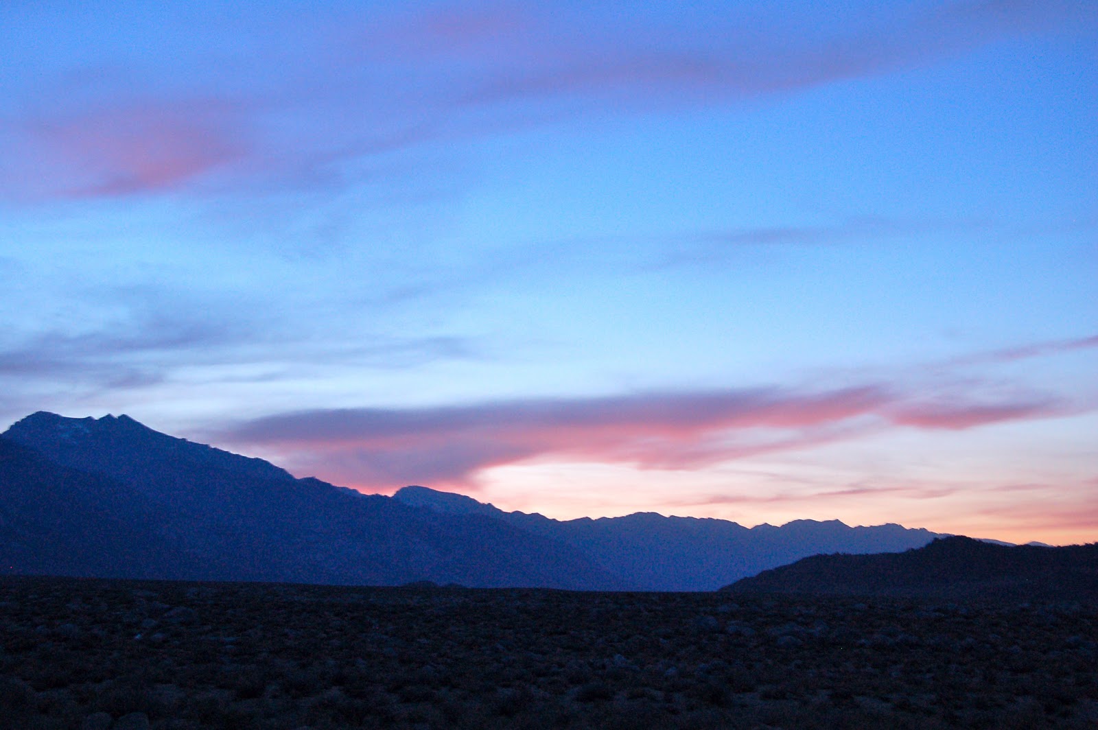
The area around Skagway reminds me of the saying..."Location, location, location."  It's an incredible piece of real estate. With a population of less than 1000 during most of the year, there are some 800,000 tourists and adventure seekers who set foot in this company-government town during the summer that's found at the northernmost point of the Inside Passage. A mere 100 miles by air to Juneau, capital of Alaska, it's 112 scenic miles by road to Whitehorse, capital of the Yukon. Signs, books, and an endless stream of literature remind us that it's the gateway to the Klondike. I looked at the maps and tried to figure out what I would do if I had been one of those eager, adventurous, crazed gold seekers. Of the 100,000 people who tried, less than one percent found the yellow stuff, at least enough to turn a profit. That's less than 1000 dreamers who dared to follow the yellow brick road to wealth. Yikes!

One of many cruise ships that reach Skagway by the marine highway.

Would I have been so tempted? Well ... when I retired I stuck a fair amount of money into the stock market and experienced three great declines that wiped out a good deal of our capital. So who made all that money in the great USA during the past 20 years? It wasn't
the gold seekers like me...no it was the same types who prospered during the Klondike days. You know! The ones who supplied the shovels, the tents, the gold pans, the boats, the women, the food...but now in the ongoing modern "gold rush" we call them stockbrokers, option traders, hedge fund managers, bankers, corporate CEO's of multinational corporations, the people of Wall Street. It's a bit chilling to learn that about one percent of the US population currently owns 90 percent of its resources in this day and age.  Or...is that just made up?

The ferry crossing to Haines from Skagway.

I suspect that the Klondikers were as confused and despondent from the 1893 stock market crash and following economic depression as many are today from the housing debacle of 2008 and the possible crash that looks more and more likely in 2012 regardless who is in office. Fewer than 3000 people took the "all-water" route from Seattle to St Michael, Alaska and then up the Yukon River to Dawson.  Frankly that's the route I would have selected. But most people didn't have the funds to pay for ship passage.  And, on reflection, my wife and I opted out of the marine highway route ourselves because of the cost... about $1500 for us and our beloved motor home, "Dorothy." That meant we had to go overland, a trip that took us nearly two weeks due to our comfortable, slow paced speed of 50 miles per hour to soak it all in, search for wildlife, and dilly dally along the way to kayak lakes, rivers and streams. We could have made it in three or four days or so by combining ship and road to Whitehorse.

So similar decisions must have plagued the early travelers to Skagway and Dawson as we recently experienced.  About 2000 prospectors went the all-land route by way of Edmonton, as described in the excellent novel, "The Journey" by James Michener. Most, however, chose a combination of getting to Skagway, then hiking the challenging Chilkoot Pass or White Pass and eventually floating down the Yukon River. It was that one ton of goods to carry 40 or so times over the passes that would have made me think and rethink the whole idea of seeking wealth in the Klondike at all.  What was that magical driving force that led men and women into such an impossible undertaking?


Gloomy weather, seagulls, and a handful of residents welcomed us to Haines, Alaska

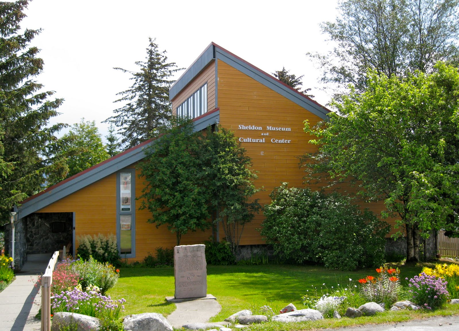
As we crossed the waterway by ferry to Haines from Skagway for a cost of $151, I thought about Skagway and Dyea. We had only been there for three days and two nights, yet it had made an incredible impression upon us, much like the first time I read Jack London's, "Call of the Wild" when I was about ten years old. What is this myth of Alaska? Who are these people? Where is this land? Fortunately, there are a number of people and buildings that house relics from the past that answer many of these questions along the way, such as the Sheldon Museum of Haines.


The Sheldon Museum and Cultural Center

The present day Sheldon Museum occupies the land that originally served as a Presbyterian mission to the Tlingit Indians.  It houses a variety of local Native artifacts as well as goods from the days of the miners and missionaries. Across the street is the unique Hammer Museum that includes over 1500 hammers and related tools. And beyond that is a small natural history museum called the American Bald Eagle Foundation that displays over 200 specimens of local fish and wildlife. For me, I mostly spent time hiking the streets, poking into bakeries, restaurants, and stores in addition to spending time in the small but comfortable library. Haines is a small, unassuming, sleepy village that gives a taste of coastal Alaska.


The Hammer Museum that houses over 1500 different hammers from all over the world.
The Bear Den is one of three bakeries in town.
                                  
I haven't found a town yet in Alaska or northern B.C. that didn't have a bakery. I am not embarrassed to say that I love bakeries. Sometimes I wander in just for a cup of coffee, the delicious smell of fresh bakery products, and meet some of the regulars who hang out there. Other times I succumb to temptation and get a Danish or a doughnut.  But the thing to buy in Alaska is fresh Rhubarb pie a la mode. That is an Alaskan specialty and in May and June it's rhubarb season. I have taken on the research project of checking out the bakeries of Alaska. So far, I have found that most bakery regulars come from someplace else, including the owners.  The husband-wife team who own the attractive Chilkat Bakery come from Portland, Oregon and spend the summers in Haines. They had a thriving business of combining a restaurant and bakery together that attracted tourists as well as locals.

The Chilkat Bakery in Haines


Saturday, July 31, 2010

Introduction to the Chilkoot Trail

There were a host of reasons Nola and I wanted to visit Alaska this summer of 2010. For me they not only involved the opportunities to fish, kayak, hike, and explore, but to learn more about the colorful history of Alaska. By hiking the Chilkoot Trail, we could retrace the journey of the 1898 prospectors firsthand. Another big one, however, involved investigating the history of my grandfather who ran off to Alaska from Waterville, Maine sometime in the late 1920s. He left his family of five young sons and a wife behind to fend for themselves during the Great Depression and eventually returned many years later in a pine box.  I assumed that he ran off to make a fortune in the goldfields, but by then the gold had played out and it turns out that he worked on the railroad somewhere between Anchorage and Fairbanks according to family history. I found that the railroads were just as important as gold in establishing the early fortunes of Alaska. Indeed, the city of Dyea died out rather quickly in the early 1900s when Skagway was chosen as the main starting point for the railroad to Whitehorse and beyond.

The Beginning of the Chilkoot Trail at Dyea Campground

In the days of the actual gold rush, prospectors were normally ferried from Skagway to Dyea where they would start preparations for hiking the Chilkoot Trail to eventually reach the goldfields around Dawson City some 600 miles away. This was the most popular access route from the coast to the Yukon goldfields, the shortest and least expensive.  In 1898, Dyea had 150 businesses, 48 hotels, and 2 hospitals. By 1903, all were abandoned leaving just three people as the resident population. Today, the combination of this historic American and Canadian route is celebrated and preserved as part of the Klondike Gold Rush National Historic Park (USA) and Chilkoot Trail National Historic Site (of Canada). For the early prospectors, it was necessary to haul one ton (2000 pounds) of gear over the Pass to the Canadian side which included such things as 150 pounds of bacon, 400 pounds of flour, 125 pounds of beans, 75 pounds of dried fruits, and other assorted foodstuffs including coffee, tea, sugar, etc. In short, enough provisions to last one full year.

Nola on the way up Saintly Hill in the first mile of the Chilkoot Trail


For us? Well...forget the one ton of goods. We decided to bring our day packs, take a lunch, pack our rain gear, wear bear bells, and make an exploratory trip of one day to Finnegan's Point, about 7 miles round trip from our campsite. We wanted to test it out to see if we were really interested in completing the entire hike of 33 miles to Bennett Lake in B.C. at a later date. But it became apparent after completing the first leg of the journey up Saintly Hill that Nola's ankles and feet would not survive the whole trek without a lot of pain. In my case, I was surprised at my huffing and puffing at the beginning, but felt a lot better by time we reached the top. I attributed my own slow pace to being out of shape from too much driving instead of biking or hiking up demanding hills and mountains. So, this hill was just enough challenge to start the trip off. It felt great when we reached the top and a relief to find out that the trail was not all straight up for the entire day. Saintly Hill deserves its name from the fact that anyone is a saint if they do not curse on their way up. Despite the initial challenge, I ended up loving the trip and I found out quickly that I am no saint.

 Love those well built bridges that make the trail flat, dry and scenic.

Zen views of Face Mountain 

The initial hills gave way to well worn trails that often bordered the Taiya River offering a variety of zen views. We eventually walked across swampland aided by parallel walking boards. That made it easy and exciting at the same time looking for beaver, muskrats, and birdlife along the way. Can't imagine what the trail looked like in 1898.

Crossing the swampland looking for beaver, muskrats and birdlife.

Eventually we penetrated a dark, brooding forest with zillions of mosquitoes droning around our heads...among our first in Alaska. As long as we kept walking it wasn't so bad, but we rested a few minutes for a quick lunch and they attacked us like the Mongol warriors of Genghis Khan. That was the quickest lunch ever as we had forgotten our head nets thinking we had somehow escaped mosquito season. Big mistake!

The dark forest beckons the unwary hiker.

It was tough for me to turn around at only 3.3 miles and retrace our steps. I really wanted to see what was up ahead and go through the more challenging parts of the trail experiencing Canyon City, Pleasant Camp, Sheep Camp, The Scales, The Golden Stairs, the Chilkoot Pass, and the trails to Lindeman and Bennett Lakes. So I decided to do it later in the summer by myself and join another 50 or so hikers who would sign the register, pay $50 in fees, and join the tens of thousands of others who have made this trek in the past. This appeared to be a challenging hike offering a variety of scenery with remnants of items along the trail left by earlier hikers and prospectors, and a good feeling for what it must have been like during those earlier days.  Of course, the first day was the easy part.  But...it looks like a great adventure!

 A documentary in the making with Canadian actor volunteers and Canadian Public Television of Quebec.


As we made our way back along the path, we started meeting more day trekkers. Most were part of small tour groups offered by Princess Cruise Lines who practically owned the nearby port of Skagway. But the biggest surprise was to meet a television production crew and volunteer actors from Canadian Television making a film for Public Television in Quebec. With a group of about 20 people selected from all over Canada, they were involved in the reenactment and filming of the early French voyagers and prospectors who had climbed the Chilkoot Trail and went on to Dawson City.  Dressed in typical dress of the time, using similar tools, camping and cooking like those of 1898, the film would document what it was like for today's adventurers to spend three months slowly making their way with all of their struggles and  triumphs to Dawson City. With any luck, we would meet them once again on their entrance to Dawson City in August.

        One of the Canadian actors with blisters becomes the cook.

Two actors had blisters from the old style boots used on the trek and spent their days in camp as cooks and camp helpers. Note the use of flip flops for the day as their feet healed.  The documentary required that all actors wear clothing of the time for the entire length of the film (three months), and eat similar food from their 500 pounds of gear they were required to transport for this journey (rather than the full 2000 pounds per person for a year).

Home Sweet Home on the Chilkoot Trail


Thursday, July 22, 2010

Part II. Whitehorse to Skagway, Alaska

We spent our last night in Whitehorse at the local Walmart where we free camped with 35 other RV rigs.  It was a bit like an RV rally of people driving to Alaska and points north. Met one traveler who was developing a bear alarm for tent campers to warn them if a bear was too close while they were sleeping.  A fairly simple device with a nylon line rigged around the tent so that a pocket sized alarm went off if something disturbed it.  He showed me the prototype and it looked good to me. For the previous five nights we have stayed at the Hi Country RV Park which provided a rest bit and a chance to catch up on the internet, collect mail, take a long shower, do laundry, and explore Whitehorse on foot. But now we are set to embark on Part II of our adventure...driving to and experiencing the real Alaska!


The road to Skagway from Whitehorse is called the South Klondike Highway and is the most scenic route into interior Alaska (or so I was told). It's another journey into the beauty of the natural world with snow capped mountains, emerald lakes and glacial rivers presenting one spectacular view after another.  Only 110 miles in length, this is a great side trip off the Alaska Highway either continuing by ferry to Haines and other southeast Alaska points or returning back to Whitehorse to continue on to Tok, Alaska. 


Yahoo! Our first entry to Alaska was near the outpost of Fraser, British Columbia.  The border crossing was easy with one lone patrolman asking us a few casual questions about where we had traveled and future destinations in a cheery manner. This was in contrast to the Canadian border patrol who have been stern, uptight, and all business on our previous crossings into Canada. I commented to my wife..."What's their problem?" On the other hand, I wonder how the American border patrol treats the Canadians. On this trip I have heard horror stories about Europeans entering the USA by air and grilled up to 30 minutes, not once but several times as they move from one area of the airport to another. As a result, I have met several German and Swiss travelers in B.C. who told me they refuse to travel to the USA now and confine their North American travel to Canada. The last time I traveled from Istanbul, Turkey to New York, I was questioned four times with accompanying baggage search before I was allowed to enter the airplane. I asked the Turkish authorities about the redundant searches and one officer replied that it was demanded by the American authorities. It's a sad time for world travel and the air industry as compared to the hey days of Pan Am and TWA when air travel was great fun.  After more than 50 years of flying around the world many times on business and pleasure, I rarely travel by plane anymore and much prefer to drive our motorhome or tour by recumbent bicycle. 


One of my goals on this trip was to experience the days of the Klondike and get a feeling for what it must have been like to search for gold in the frenzy of the Gold Rush of 1898. No better place to begin this side adventure than camping at Dyea Campground and possibly hiking the Chilkoot Trail over White Mountain Pass and relive the stories and days of yesteryear. We entered Dyea Junction in the late afternoon of June 8th about ten miles prior to reaching Skagway; left the tarmac and traveled eight miles on a twisting, gravel road to the former town of Dyea.  We were at the starting point of the Chilkoot Trail and the former site of a city that contained a population of over 10,000 people in 1898 that rivaled Skagway in size at the time.  Now a National Historical Park, all that's left are remnants of a wharf that received supplies and gold seekers traveling up the inland passage, a few scattered buildings, a cemetery, and a campground for present day visitors. 


We were very fortunate to meet the campground volunteers, Judy and Jim Finses of California, who took us on a personal tour of Dyea and learned that there were over 40 graves in the Slide Cemetery many bearing the date of the Palm Sunday avalanche. After viewing the waterfront remains, the Taiya River where pink salmon swim upstream in July pursued by brown and grizzly bears, and the remains of Slide Cemetery, we were ready to hit the sack and dream about the Gold Rush of 1898.  Jim left us with one admonition, "Beware of the grizzly bears in camp!"