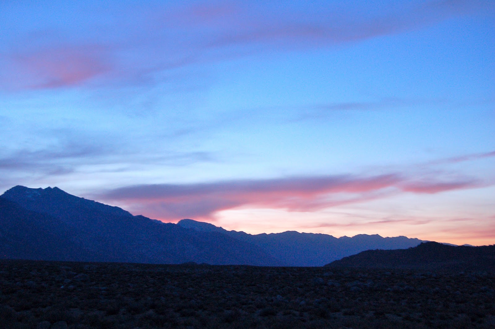
Friday, April 26, 2013

Eastern Sierra Nevada

Leaving Death Valley for Lone Pine, CA

By our fourth day, we realized we could stay in Death Valley for a week or two at least.  However, this trip was a reconnaisance to plan for the future. Next time we will arrive in February to avoid the heat and the crowds of March. The big question was how to drive over to Lone Pine, our next objective.
We did our research online as well as talked to quite a few travelers and rangers about the best route.  On the map, it looked like 190 was the way to go.  Comments about this route varied from "insanity with a motorhome" to "an easy way to go."  I decided to go for it, rather than spend several extra hours going through Beatty, Tonopah, and then over to 395.

By going slowly and using second gear, it was an easy trip going through Panamint Springs up to Owens Lake and connecting with 136 to Lone Pine.  The views are spectacular, well worth the ups and downs on excellent roads.

Lone Pine and Tuttle Creek Campground

It's an amazing journey to the Eastern Sierras from the desert observing Mt. Whitney as our navigational beacon. Comfortable temperatures and sunny conditions welcomed us to route 395, one of our favorite drives in the USA.  Last year we had explored a number of campgrounds in the region and we had settled on Tuttle Creek, a BLM campground nestled beneath the shadow of Mt. Whitney, just above the Alabama Hills, and a few miles from Lone Pine, California.  This is one of our very favorite campgrounds in the American west.  For a fee of $2.50 a night (dry camping), we were snuggled into a site with shade trees not more than ten yards from a trout stream recently stocked with 12-14 inch Rainbow Trout.  It just doesn't get much better than this!


View from Lone Pine past the Alabama Hills to Mt. Whitney


At Home at Tuttle Creek BLM Campground


Tuttle Creek, a few yards from our motorhome


A 13 inch Rainbow Trout for Dinner


Views past the Alabama Hills to Inyo Mountains from our Campsite


Evening Sunset towards the Sierra Nevada


Wednesday, April 24, 2013

Mesquite Flat Dunes

Stovepipe Wells

The thing about Death Valley is there are so many possibilities. And, it's relatively flat for easy driving in this part of the park. It was time for us to move on however, and we set up a new base camp at Stovepipe Wells, about an hour away from Furnace Creek.  We were especially attracted to the dunes and their easy access from the road close to the RV Park. Like yesterday, lots of wind but a drop in temperatures made it appealing to explore in the morning and evening.

Mesquite Flat Dunes

The Mesquite Dunes are a photographers paradise depending on the time of day. They are easy access from the road and I can see the movie companies from Hollywood coming here again and again for some prime footage. Just happens we are watching the old series of "Kung Fu" on DVD with David Carradine playing Kwai Chang Caine (Grasshopper) as a Shaolin priest. The first introduction of every episode starts with Caine trekking through these stunning sand dunes.  Now we have our chance of walking through them as well.  They are in a gorgeous setting with lofty mountains on all sides and rise up to 150 feet, primarily caused by erosion of the nearby Cottonwood Mountains.


Photography by David Roderick


Tuesday, April 23, 2013

Lowest Point in North America

Badwater Basin

Temperatures dropped in the early morning and cooled things off enough to encourage us to drive to Badwater Basin, the lowest point in North America, at 282 feet below sea level according to the sign, but Ranger Bob said it's now lower at "284 feet below".  Good enough for me! Visitors from all over the world joined us at the site, walking and gawking and clicking cameras to record this auspicious moment. I looked down and then up. OK! Where is Mt. Whitney, the highest point in the continental USA?  Couldn't see it but I heard there was an ultramarathon in a few months that goes from this very site to the trailhead of Whitney Portal (8360 feet).  It's described as the toughest race in the world with a 13,000 foot cumulative elevation gain.  And...get this. It's in mid-July when the temperatures are hottest all around.  How hot?  120 degrees and up.  That  adds up to about 157 miles on land with a course that has to go around lots and lots of natural obstacles, like salt beds, steep canyons, sand dunes, rattlesnakes, gold mines, and then bears as you get to the mountains. Just kidding. Or, am I? Originally it went all the way up to the top of Mt. Whitney at 14,494 feet above sea level.  But lots of regulations changed this event when the National Forest Service required permits to hike to the summit.  I did it over 30 years ago and it took me at least three days for the round trip from...no! not Badwater Basin...but from Whitney Portal.  Thank God I did it then!  


The lowest point in North America at 284 feet below sea level


Visitors from all over the world joined us at the lowest point in North America

Artist Drive

We then slowly drove in the direction back to Furnace Creek to take-in the majestic Artist Drive.
Turning to the right, away from the salt flats to the Black Mountains, we took a one way surfaced road that meandered through a series of volcanic rock layers painted in reds, purples, pinks,orange, yellow, browns, blacks, and whites...with all kinds of related hues and colors in-between.  A natural palette that is stunning to the eye.  Lots of places to walk and get out of the car for more detailed observations while being on the lookout for rattlesnakes and other creatures I have no wish to discover at 100 degrees.  This rock formation is actually called the Artist Formation dating back to the Miocene about 10,000 years ago during a particularly violent and explosive period of volcanic action.  The colors are due to "chemical weathering and hydrothermal alteration", especially the rocks that contain iron (hematite) as they tend to oxidize and yield the rusts and reds and browns and greens.  OK! I confess. My first college degree was in geology.  But the guidebook helps with the description.

A stunning panorama through the Black Mountains and the Artist Drive


The Inn at Furnace Creek

It was time to return to the cooler climes in such places as the Inn at Furnace Creek for a gin tonic to celebrate the fact that we are still alive and didn't fall down a crater to the center of the earth or get bitten by a giant rattlesnake or get eaten by a saber tooth tiger lurking around from the Pliocene.
In rather British fashion, we retreated to the deck overlooking the valley with a six dollar gin tonic in hand to toast each other for a good day's work done.  Of course, we will retreat to our RV domain at some later point, but in this air conditioned affluence, we enjoyed every minute of it.  The rooms here, for the rich and famous, start at $340 plus taxes and other fees, to $480 for a suite.  


The lovely Inn at Furnace Creek for those who prefer a bit of luxury in the desert


Monday, April 22, 2013

Death Valley National Park

Furnace Creek

Time to leave Pahrump, Nevada where we spent the past week getting ready for our annual spring trek to Route 395 and the Sierra Nevada with its lofty mountains, lakes, rivers, and creeks around Lone Pine, Bishop, and Mammoth, California. In my opinion, this is one of the most beautiful stretches of land in the world sharing the lowest (Badwater Basin) and highest points (Mt.Whitney) in North America. This year we decided to cut through Death Valley for a few days before camping, hiking, kayaking, and fishing our way up north to Oregon.


Entrance to Death Valley National Park along Rt. 190

                                     
Taking Rt. 160 out of Pahrump to connect with Rt. 190, it was less than an hour before we entered the National Park. Excellent roads along the way, especially within the park.  Met a great group of motorcyclists from Western Canada at the Park sign where we took photos of each other.        

Road into Furnace Creek along Rt. 190


Then into the park, bypassing Dante's View, but stopping at Zebriskie's Point.  Nola mentioned to me, "You know, it's kind of hot here at 2:00 PM." Little did we know the temperatures were over 100 degrees.  But the walk up to the Point is well worth the time and effort as a beautiful panorama of badlands with different hues and colors jump out at you. This is an ideal place for sunrises and sunsets.


The Badlands at Zebriskie Point


We drove slowly into Furnace Creek, admiring the luxurous Inn and more approachable Ranch at Furnace Creek on the way before entering the cool, lovely habitat of the Visitor Center.  On the way in we noticed a temperature reading...106 degrees. Yikes!  106 degrees.  Couldn't believe it!  Would have melted if we were on the East Coast.  Here...it's dry heat, but nonetheless, I had a water bottle in tow and drank every few minutes, which is totally unusual for me.  Haven't experienced such thirst in years!
After getting the lay of the land and checking out two different RV Parks across from the Center, we decided to stay at Texas Spring Camp, set aside with areas for tenters as well as RVers.  Better scenery with broken hills and valleys to view but trees and shade reserved for tenters.  Having tented for 70 years, I figured they deserved it. Down below was another RV Park called Sunset, which seemed less inviting at the time. Kind of flat gravel sites without much wind or sun protection. Besides the intense heat, the winds came in gusts every once in a while with a strong warning not to put our awnings out to create an outdoor room.  With Golden Age card, the RV sites were $6 (Sunset) and $7 (Texas Springs).  Only a handful of RVers in either park.


Ranger Bob Telling the Story of Harmony Borax Works and the 20 Mule Team

After a healthy dinner of Greek Salad, and lots of ice water to quench our thirst, we drove our car over to Harmony Borax Works site at 7 PM for a talk by Ranger Bob on the history of the Borax Works and 20 Mule Teams.  Bringing our own chairs and water, we joined a small group of fellow travelers, learning about the short and profitable history of the Borax Works.  By bringing Chinese laborers from San Francisco to dig the whitish borax out of the ground, they piled it into narrow wagons led by 18 mules and two horses, and two teamsters across 165 miles of desert to the railroad head in Majove.  Started in 1883, things went great for five years and huge profits were made by the owner, W.T. Coleman. However, the company went bankrupt  by 1888 because the owner's sons talked him into investing most of his wealth into a sure thing with even greater profits.  Been there...done that! 

One final note to end the day.  Winds plowed along at 25 mph all night with gusts up to 50 mph.  The temps in the RV were in the low 90's before dropping into the 70's.  The worst night on the road, ever, with rocking and rolling, wondering if our kayaks would fly off into the next county.  Forget April, come here in February or early March.